
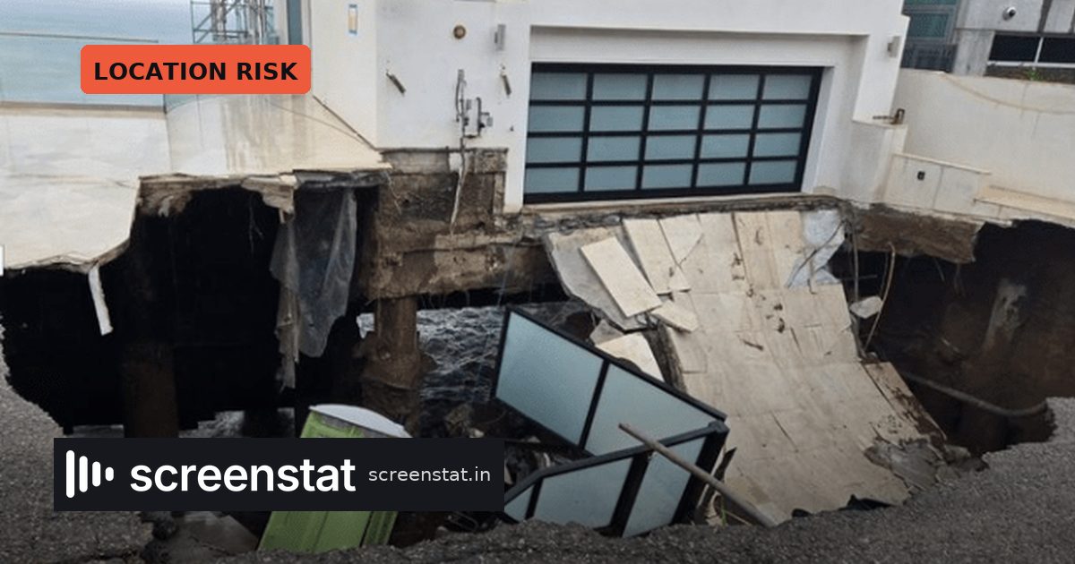
Southern California’s most photographed coastline took a beating this week. Swell driven by the remnants of Hurricane Marie carved a sinkhole into the sand beneath a multimillion-dollar Malibu beachfront home, triggered evacuations in Long Beach, and left about a dozen Dana Point properties red-tagged as uninhabitable.
For anyone who plans shoots, insures them or budgets them, this is not a lifestyle story. It is a location-risk story about the stretch of coast that doubles for “California” in an enormous share of American film, television and commercial output.
What happened
Per Deadline, Los Angeles County Fire crews responded around 5:45 a.m. Tuesday to the 31600 block of Sea Level Drive East, in the secluded Point Lechuza community near Broad Beach. They found a sinkhole plus a ruptured gas main. The house remained standing on its pilings, but the driveway was gone and sections of the private street had dropped toward the water. Southern California Gas Company shut off the gas; the sheriff’s department and county fire closed the road.
A fire department spokesman said the home was not occupied. The City of Malibu reportedly red-tagged five homes and said its Building Safety Division would keep assessing the area with SoCal Gas.
Elsewhere along the coast:
- Long Beach: roughly 20 homes evacuated along Seaside Walk between 63rd and 67th Place after the seawall was compromised and the boardwalk damaged.
- Dana Point: about a dozen high-priced homes red-tagged, with at least one beachfront building’s slab foundation undermined.
- Pacific Palisades: further erosion around the pilings left from homes destroyed in last year’s fire.
- Seal Beach and Zuma Beach: parking lot flooding, with high tides running well over seven feet.
High surf and coastal flood advisories covered parts of the LA County coast through Tuesday night, with Orange County’s coastal flood advisory extended to Wednesday night. The storm itself stayed well offshore but aimed waves with 10-foot faces at south-facing beaches.
Why production people should care
Malibu, PCH and the Orange County coast are working locations, not just real estate. Red tags, closed private roads and a gas shutdown mean access restrictions that can land with no notice on a day when a unit is already loaded in. Malibu officials said they are actively responding to coastal erosion along PCH in the Palisades Fire burn area and at Westward Beach.
The longer-range signal matters more. The National Climate Prediction Center last month put the odds of a very strong El Nino event in fall and winter 2026-27 at greater than 90%. Malibu said it is preparing for strong storms, heavy rain, mudslides and coastal erosion across the Southern California coast. In plain terms: the beach that just eroded is the same beach that has to absorb winter swell.
The practical read
Treat coastal LA as a variable-risk location tier this season, the way productions already treat wildfire windows in late summer.
- Build alternates for any beach or PCH-adjacent day between now and spring, and price the swap in prep, not in a panic.
- Check whether your location’s access road is private. Private roads close fast and reopen slowly.
- Front-load coastal exteriors where the schedule allows, rather than parking them in January.
- Confirm weather-day and civil-authority language in insurance before the first strong El Nino system, not after.
None of this is exotic. It is the same discipline that studios apply to monsoon shoots in Mumbai or typhoon season in East Asia, now applied to a coastline that has long been treated as reliably shootable. That assumption is the thing the numbers are quietly revising.
Source: Deadline